
Best The Andes Photo Spots
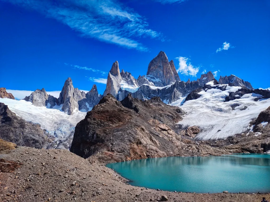
Argentina’s Andes contain vastly different landscapes, and this photography guide focuses on the granite peaks and glacial lagoons around El Chaltén. Four hiking objectives form the core of the plan: Laguna de los Tres, Laguna Capri, Laguna Torre, and Loma del Pliegue Tumbado. Each offers a distinct way to photograph Mount Fitz Roy or Mount Torre, with weather flexibility as important as camera technique.
Why El Chaltén Works for Andes Landscape Photography
El Chaltén is the practical base for photographing the Fitz Roy and Torre landscapes on foot. Laguna de los Tres supplies the classic Fitz Roy composition, Laguna Torre ends opposite Mount Torre, Laguna Capri offers a comparatively more accessible alternative with strong views, and Loma del Pliegue Tumbado changes the angle on Fitz Roy. The choices let photographers match the day’s energy and conditions to a specific visual goal.
- Make Laguna de los Tres your headline goal if you are prepared for a demanding, nearly nine-hour outing.
- Keep Laguna Capri in reserve for a comparatively lower-demand walk with rewarding mountain views.
- Use Laguna Torre to put Mount Torre, rather than Fitz Roy, at the center of the frame.
- Allow three to seven days in El Chaltén so wind and cloud do not dictate the whole trip.
- Check trail conditions, maps, and current entry rules locally before setting out on a long walk.
The Four Essential El Chaltén Photo Spots
These four locations are best treated as separate photographic objectives rather than stops to rush through in one outing. Start by deciding which mountain, viewpoint, and level of walking effort matter most to you. That simple choice makes it easier to use changing conditions well once you are in El Chaltén.
Laguna de los Tres for the Signature Fitz Roy Frame
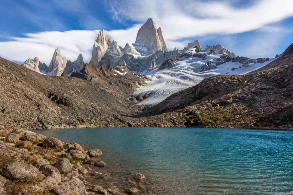
Laguna de los Tres is the defining image: Fitz Roy’s jagged peaks rise above an emerald-colored lagoon. It is the strongest choice for travelers who want the classic mountain-and-water composition, but it earns that status through effort. The full outing is described as taking nearly nine hours, so plan it as a serious hiking day with photography built into the pace.
Give this objective your best available weather window. A clear view is the priority, so avoid treating a single calendar date as a guaranteed shoot. Carry your camera in a way that keeps it protected yet quick to reach, then leave enough energy for a deliberate final stretch and time at the lagoon.
Laguna Capri for Strong Views With Less Demand
Laguna Capri is the useful alternative when you want a Fitz Roy view without committing to the full Laguna de los Tres objective. It is presented as a comparatively more accessible hike with strong mountain views. That comparison makes it a smart choice on a shorter day or when you want to save your biggest push for a more promising forecast window.
Laguna Torre for Mount Torre’s Dramatic Profile
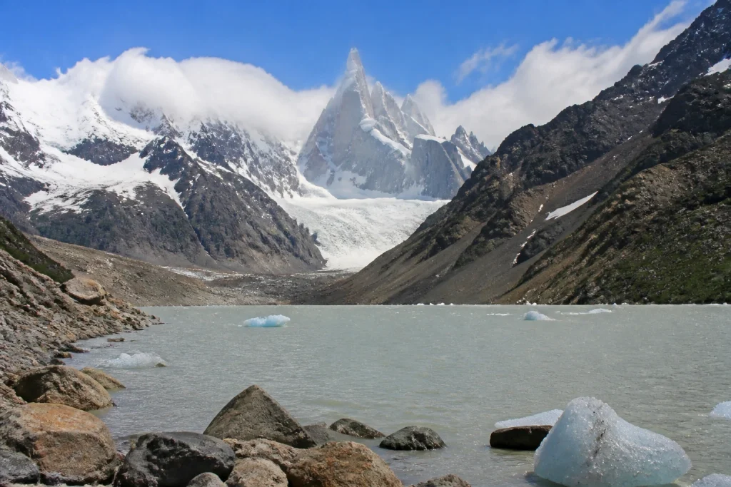
Laguna Torre shifts the subject to Mount Torre. The hike finishes opposite the mountain, creating a different photographic destination from the Fitz Roy routes. Add it to the itinerary when you want a distinct summit profile and a second major landscape goal, rather than repeating the same Fitz Roy viewpoint in changing weather.
Loma del Pliegue Tumbado for a Different Fitz Roy Perspective
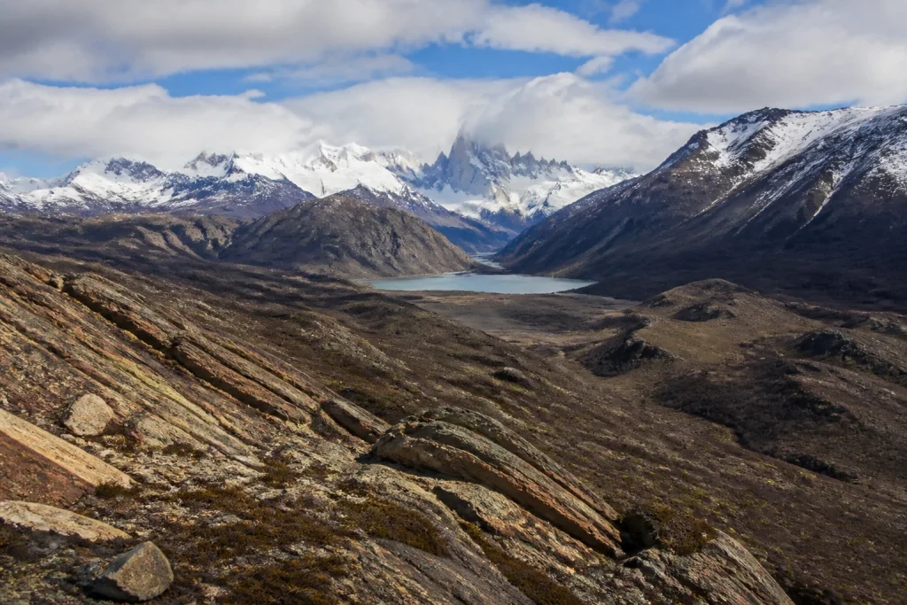
Loma del Pliegue Tumbado is the choice for photographers who want to move beyond the standard Fitz Roy composition. Its value is the changed perspective on the mountain. Build it into a multi-day stay as a fresh visual option, especially after you have already photographed Fitz Roy from Laguna de los Tres or Laguna Capri.
Choose the Right Viewpoint for Your Time and Energy
| Photo spot | Main subject | Effort cue | Best use in a photo plan |
|---|---|---|---|
| Laguna de los Tres | Mount Fitz Roy and an emerald lagoon | Demanding full outing, described as nearly nine hours | Prioritize it for the classic Fitz Roy image. |
| Laguna Capri | Fitz Roy views | Comparatively more accessible hike | Use it for a less demanding mountain-view day. |
| Laguna Torre | Mount Torre | A hike ending opposite the mountain | Choose it for a different summit and landscape subject. |
| Loma del Pliegue Tumbado | A changed Fitz Roy perspective | Walking objective with no fixed duration stated here | Add variety after photographing the better-known Fitz Roy views. |
For a short stay, pick one primary objective and one backup instead of trying to collect every viewpoint. Laguna de los Tres has the biggest effort-to-payoff tradeoff. Laguna Capri gives the most practical flexibility, while Laguna Torre and Loma del Pliegue Tumbado broaden the portfolio once you have time for more than one long walk.
Plan Around Wind, Cloud, and the October-to-March Season
October through March is the recommended period for visiting El Chaltén. Summer brings stronger winds, and temperatures can change rapidly, so a beautiful forecast is not a substitute for warm layers and a flexible schedule. Use the first clear weather break for your highest-priority viewpoint rather than saving it for a preselected day later in the trip.
A three- to seven-day stay gives photographers room to adapt to cloud, wind, and visibility. Keep one demanding hike in reserve for the clearest available day, and prepare a second plan with a different effort level. This approach is more productive than building the trip around a promised sunrise or fixed summit view.
Reach El Chaltén and Check Conditions Before You Hike
El Calafate is the nearest airport gateway for El Chaltén. The town is reached overland from El Calafate, about 210 kilometers away. Arrange your transportation around the confirmed details of your arrival and departure, then avoid scheduling a major hike immediately after a long travel day if you can help it.
Once in El Chaltén, visit the Los Glaciares National Park Visitor Center at the town entrance or the municipal tourism office for trail maps and current conditions. This is a worthwhile first stop for photographers because wind, weather, and trail updates can reshape the day’s plan before you commit to a long walk.
Check current National Parks entry and ticket rules before travel. A 2025 destination report stated that trails toward Fitz Roy and Cerro Torre required a National Parks ticket, but practical rules and costs can change. Confirm the current requirement while finalizing the trip rather than budgeting around an old price.
Carry a Wind-Ready Camera Kit
El Chaltén’s strong winds and fast temperature swings reward a simple, weather-ready kit. Pack only equipment you can carry comfortably for the full walk, and protect the gear that matters most. A lighter setup used consistently is more useful than a heavy bag that slows every uphill section.
- Sturdy footwear and clothing layers suitable for rapid changes in temperature.
- A weather-resistant camera bag or protective cover for wind and moisture.
- A wide lens for broad peak-and-lagoon scenes, plus a short telephoto if weight allows.
- A microfiber cloth and spare battery kept in an inside pocket.
- Food, water, navigation essentials, and enough space to pack out all waste.
At the viewpoint, begin with the wide composition that includes the mountain and lagoon or foreground, then look for smaller studies of ridgelines, changing cloud, and water texture. In strong wind, stabilize yourself before worrying about a tripod. Keep the lens cloth handy, work methodically, and protect the camera before moving on.
Build a Flexible Three-to-Seven-Day Photography Plan
El Chaltén rewards a stay of three to seven days because weather flexibility is built into the destination advice. That range gives you a realistic chance to treat the mountains as changing subjects rather than a one-shot assignment. The sequence below is a planning framework, not a fixed hiking schedule.
- On arrival, visit the park visitor center or municipal tourism office, collect current maps, and decide which viewpoint is your top priority.
- Use the first strong weather window for Laguna de los Tres if the demanding walk suits your fitness and available daylight.
- Use another suitable day for Laguna Capri, Laguna Torre, or Loma del Pliegue Tumbado to create a different set of mountain images.
- Keep an extra day open for wind, cloud, rest, or a return to the viewpoint that best matches the conditions.
Photographers continuing beyond Patagonia can pair this focused plan with the broader Best Places To Visit In The Andes guide for destination-level inspiration elsewhere in the mountain range. Keep the El Chaltén portion of the trip deliberately spacious, though. Its best photographs depend on having time to respond to the mountains instead of racing a tight itinerary.
Photograph With Care on Busy Trails
Keep your shooting setup compact on narrow or busy sections, let other walkers pass, and avoid stepping off established ground just to improve a composition. The best Fitz Roy and Torre images already have powerful natural structure. Patience with light, cloud, and framing will do more for the result than forcing an unsafe or damaging position.
Keep camera equipment close and stay aware of your surroundings in tourist areas. Argentina is rated Level 1, meaning normal precautions are advised, though official travel guidance still notes petty crime in tourist locations. This is a routine travel precaution, not a site-specific warning for El Chaltén.
The Best El Chaltén Photo Plan Starts With Time
For the classic Andes mountain photograph, Laguna de los Tres is the goal that deserves the biggest effort. Laguna Capri offers a useful lower-demand alternative, while Laguna Torre and Loma del Pliegue Tumbado expand the visual story beyond one familiar frame. Base yourself in El Chaltén, allow several weather-flexible days, and choose each hike according to the conditions in front of you.
Frequently asked questions
What is the signature Andes photo spot near El Chaltén?
Laguna de los Tres is the signature photo spot near El Chaltén. It combines Mount Fitz Roy’s jagged peaks with an emerald-colored lagoon and is widely presented as the classic Fitz Roy postcard view.
How demanding is the Laguna de los Tres hike?
Laguna de los Tres is a demanding full-day walking objective. The complete outing is described as taking nearly nine hours, so it suits travelers ready to prioritize a long hike for the classic Fitz Roy image.
When is the best time to photograph El Chaltén?
October through March is the recommended visiting period for El Chaltén. Summer can be especially windy and temperatures change quickly, so allow multiple days and use the clearest weather window for your main hike.
Do I need a ticket for Fitz Roy and Cerro Torre trails?
Check the current National Parks rules before traveling. A 2025 destination report said that trails toward Fitz Roy and Cerro Torre required a National Parks ticket, but entry procedures and costs can change.
Where can I get current trail information in El Chaltén?
Get current trail information at the Los Glaciares National Park Visitor Center at El Chaltén’s entrance or at the municipal tourism office. Both are recommended sources for trail maps and current conditions.
Laguna de los Tres delivers El Chaltén’s classic Mount Fitz Roy and lagoon composition by Ani Coloca, Pexels.
More bookable experiences
Three tours to compare
Review current provider details before booking. Discover Andes may earn a commission at no extra cost to you.
Continue exploring
More practical guides selected from the Discover Andes library.
Best Mountains in the Andes
Compare four standout mountains in Argentina’s Andes, including Aconcagua, Fitz Roy, Cerro Tronador, and Lanín, with practical guidance…
The Andes Solo Travel Guide
Plan a rewarding solo trip through Argentina’s Andes by choosing the right region, timing mountain travel carefully, and…
The Andes Art and Culture Guide
Explore the art, living traditions, museums, historic streets, crafts and high-desert cultural landscapes of Argentina’s northwest, with practical…
The Andes New Year’s Eve Guide
Plan New Year's Eve in the Argentine Andes with practical advice on Mendoza, the Uco Valley, Bariloche, summer…