The Andes Walking Tours Guide

Argentina’s Andes offer several distinct walking experiences rather than one continuous trail. El Chaltén centers on glacier and granite scenery, Bariloche combines forests, lakes, and mountain refuges, while Mendoza opens the door to regulated high-altitude trekking around Aconcagua. Choosing the right region matters more than choosing the longest route. Your available time, comfort with altitude, preferred accommodation, and appetite for logistics should shape the decision.
Andes walking tours at a glance
- Choose El Chaltén for established Patagonia day walks that begin near town and can be completed independently or with a guide.
- Choose Bariloche for a city base, shorter lakeside walks, and more demanding routes linking mountain refuges.
- Choose Mendoza and Aconcagua for regulated high-altitude trekking where permits, acclimatisation, and expedition support take priority.
- Treat Laguna Torre as a full-day outing for many walkers because the published walking time is about 3 to 4 hours each way.
- Check current permits, registration rules, campsite reservations, insurance conditions, and seasonal tariffs before committing to transport or accommodation.
First-time visitors can narrow the choice by deciding what they want to see each morning. Granite peaks and glaciers point toward southern Patagonia. Wooded paths, blue lakes, and refuge nights favor Bariloche. A high, demanding expedition belongs in Mendoza. Travelers still comparing countries and landscapes can also use Best Places to Visit in the Andes for First-Time Visitors to place these Argentine regions in a wider Andean itinerary.
Choose the Argentine Andes region that fits your trip
| Region and base | Best suited to | Walking style | Main planning issue |
|---|---|---|---|
| El Chaltén and northern Los Glaciares | Patagonia scenery and independent day walkers | Established day trails, camping, and guided or independent trekking | Weather, trail conditions, registration rules, and campsite reservations |
| Bariloche and the northern lakes | Travelers wanting variety and city services | Easy local walks plus demanding refuge routes | Matching route difficulty and accommodation to the group |
| Mendoza and Aconcagua | Experienced walkers seeking altitude and expedition structure | Permit-based treks and guided high-altitude crossings | Permits, acclimatisation, insurance, weather, and current seasonal rules |
These regions are not interchangeable. El Chaltén makes it easy to build a trip around day walking. Bariloche works well when companions want different activity levels or when a city base is important. Aconcagua demands a more deliberate plan because even the Horcones area begins at about 2,800 meters. Expedition-style Andean crossings in Mendoza and San Juan can reach roughly 4,500 meters and typically take 7 to 10 days.
El Chaltén is the strongest base for classic Patagonia day walks
El Chaltén is the practical base for the northern sector of Los Glaciares National Park. Services and trails in this part of the park depart from town, letting visitors organize walking days without treating every outing as a remote expedition. This setup suits travelers who value flexibility, although weather and trail conditions still deserve respect.
Plan Laguna Torre as a full walking day
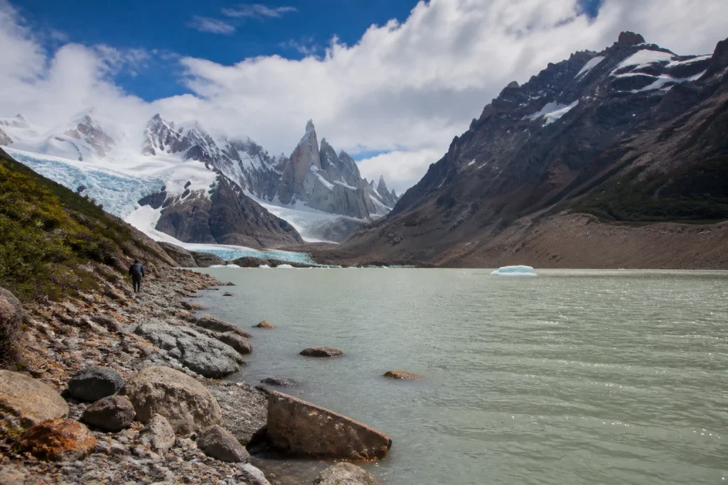
The Laguna Torre walk takes roughly 3 to 4 hours each way from El Chaltén. For many visitors, that makes it a full-day objective once breaks, photographs, changing conditions, and the return journey are included. Start with enough daylight in reserve and carry everything needed for the day. There are no food or supply services on the trails, and cell coverage is weak or absent in places.
Independent hiking is permitted in Los Glaciares, and guided walking is also available. Confident walkers often appreciate the freedom of an independent day, while a guide can help with pacing, navigation, local conditions, and interpretation. A guide becomes more valuable when the route is unfamiliar, conditions are difficult, or the group has mixed experience.
Camping requires a separate reservation plan
De Agostini, Capri, and Poincenot campgrounds require reservations through the designated park association. Keep campsite arrangements separate from park access, transport, and accommodation in your budget. A trail may begin near town, but an overnight plan still adds booking steps, food, equipment, and pack-weight decisions.
Bariloche combines easy lakeside walking with demanding refuge routes
Bariloche is the most versatile choice for groups that do not want every day to be a major trek. Official tourism information identifies lower-commitment walks around Llao Llao, Villa Tacul, and Lago Escondido. More demanding itineraries lead toward the Frey, Jakob, López, and Laguna Negra refuges, giving stronger walkers room to build a more ambitious mountain journey.
San Carlos de Bariloche’s Teniente Luis Candelaria International Airport is the main air gateway. A stay of 2 to 4 days is a useful starting point for a broader visit, although refuge itineraries or rest days can justify longer. The city base also makes it easier to balance trail time with meals, supplies, and a slower day beside the lakes.
Match the route to the least experienced walker
Do not assume that every Bariloche walk has the same commitment simply because the routes share one regional base. A local lakeside outing and a demanding refuge approach require different footwear, clothing, food, fitness, and turnaround plans. When traveling as a group, select the route for the person with the least mountain experience, then add optional distance only if conditions and energy allow.
Bariloche has a colder, drier climate with winter snowfall. That gives the region a distinctly seasonal rhythm and makes a warm-weather walking plan simpler for many visitors. Winter travel calls for route-specific advice, suitable equipment, and realistic expectations about mountain conditions.
Aconcagua requires permits and serious altitude planning
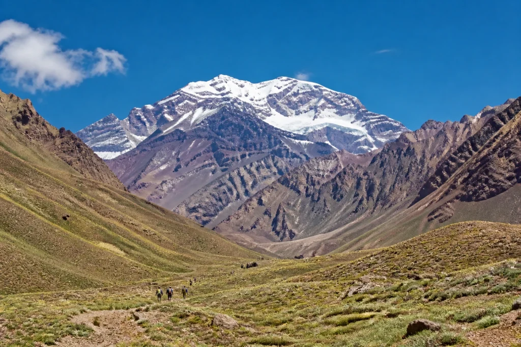
Aconcagua is not an ordinary walk-up attraction. Visitors must reserve an entry slot and pay for the appropriate ticket before traveling because tickets are not sold at the park entrance. The protected area lies about 185 kilometers from Mendoza city along National Route 7. The Horcones sector begins around 2,800 meters, so altitude influences planning even when the summit is not the objective.
The standard seasonal framework defines summer as November 1 through April 30 and winter as May 1 through October 30. Winter activities require a written request for approval. Weather or force majeure can also suspend activities, so a permit should never be treated as a promise of unrestricted access on a particular day.
Separate a park visit from an expedition
A shorter visit in the Horcones area and a long trek belong to different planning categories. Expedition-style Andean crossings in Mendoza and San Juan are physically demanding, commonly supported by mountain guides, and can reach about 4,500 meters over 7 to 10 days. Long Aconcagua treks and ascents also carry insurance requirements for evacuation and medical assistance under the published seasonal conditions.
A guided expedition is best viewed as a package of mountain support rather than a person simply showing the way. Compare acclimatisation strategy, group size, staff roles, equipment expectations, meals, transport, emergency procedures, and the exact permit category. Read the cancellation terms carefully because mountain weather can alter an itinerary.
Decide between independent walking and a guided tour
Independent walking works best on established trails when the group can navigate, monitor conditions, manage food and water, and turn back without outside prompting. Los Glaciares explicitly allows hiking and trekking either independently or with a guide. That flexibility is one reason El Chaltén appeals to experienced day walkers.
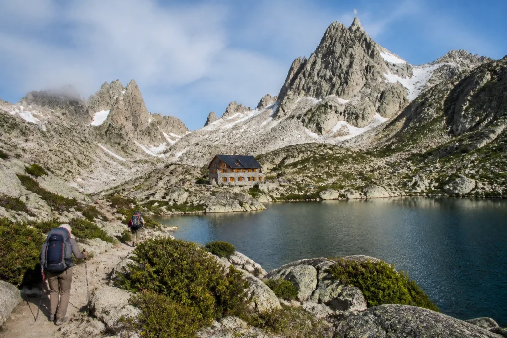
A guided Andes walking tour becomes more useful as altitude, remoteness, technical footing, or logistical complexity increases. Guides can coordinate transport and permits, establish a sensible pace, and help a group make decisions as conditions change. High-altitude crossings are firmly in this expedition-style category, while a straightforward day trail near El Chaltén offers more room for independence.
| Choose independent walking when | Choose a guided tour when |
|---|---|
| The route is established and suitable for your experience | Altitude or remoteness raises the consequences of a mistake |
| You can carry food, water, navigation tools, and spare layers | Permits, transfers, camps, or group equipment need coordination |
| You are comfortable changing plans or turning around | The group has mixed ability or limited mountain experience |
| You want flexible departure times and pacing | You want structured pacing and additional local support |
Pick the season according to the region and route
October through April is the simpler planning window for the northern sector of Los Glaciares, but no individual trail is guaranteed to be open or free of difficult conditions. Between May and September, ice, mud, and snow can make trails extremely difficult. During that winter period, poles and crampons are mandatory, and registration is compulsory for people walking the trails.
Registration is also required for climbing and remote trekking in Los Glaciares. Because rules can vary by season and activity, check the current registration requirement for your exact dates and intended route. Complete any required process before leaving reliable internet access behind.
Bariloche offers a different seasonal calculation. Winter snowfall changes route conditions, while the region’s city base gives travelers more alternatives when a mountain plan is unsuitable. In Mendoza, the formal Aconcagua summer and winter seasons control access procedures more directly. Build a flexible day into any weather-sensitive itinerary rather than making a major trek depend on one fixed departure.
Treat altitude as part of the itinerary, not a footnote
Altitude becomes central in Mendoza because Horcones already sits at about 2,800 meters and high crossings can approach 4,500 meters. Do not schedule the hardest walking immediately after arrival. Leave room for acclimatisation, keep early activity conservative, and make sure the itinerary includes a clear response when a participant feels unwell.
Fitness and acclimatisation are different issues. Strong low-altitude walkers still need a measured schedule at elevation. A plain-English altitude acclimatisation guide can help travelers understand the planning principles before comparing expedition itineraries. For a guided trip, ask how the operator structures height gain, rest, monitoring, and turnaround decisions.
Budget for permits, access, camps, transport, and support
The total price of an Andes walking trip is more useful than a headline tour rate. Separate park access, permits, campsite reservations, guides, transfers, accommodation, meals, equipment, and insurance. El Chaltén’s northern park sector charges access rights, while De Agostini, Capri, and Poincenot camps require their own reservations. Live prices should be checked before booking.
Do not rely on old Aconcagua tariffs. The latest published material in the supplied planning record covered the completed 2025-2026 summer season, so it should not be used as the price for 2026-2027. Verify the current tariff, permit category, payment process, residency rules, and insurance conditions before reserving nonrefundable travel.
When comparing guided offers, check what the advertised price excludes. A lower figure can omit park charges, personal equipment, meals, transfers, insurance, or accommodation before and after the walk. Compare like with like and make sure the itinerary names the walking days, overnight locations, expected altitude, and support included.
Carry enough to remain self-sufficient on the trail
Los Glaciares has weak or absent cell service in some areas and no food or supply service on the trails. Carry water, food, spare warm layers, sun protection, and a torch. Walk with a companion when possible and plan to return before dark. These are basic safeguards even when the trail begins close to town.
- Water and enough food for the planned route, plus a modest reserve
- Warm and weather-resistant layers that can be added or removed
- Sun protection for exposed mountain conditions
- A torch or headlamp in case the return takes longer than expected
- Navigation information that does not depend entirely on cell coverage
- Ankle-supporting trekking footwear suited to uneven surfaces
Fires are prohibited in the northern sector of Los Glaciares. Gas stoves can be used only in authorized campsites and under supervision. Overnight walkers should plan meals around that restriction and confirm what equipment is permitted at the selected campsite.
Use conservative safety rules when conditions change
- Check the day’s route conditions and any active restrictions before departure.
- Set a turnaround time that preserves enough daylight for the return.
- Carry food, water, warm layers, sun protection, and a reliable light.
- Do not depend on mobile reception for navigation or emergency communication.
- Turn back when weather, snow, ice, fatigue, or altitude makes progress unsafe.
- Review the emergency and evacuation procedure before beginning a remote or high-altitude itinerary.
A permit, reservation, or guide does not remove weather risk. Aconcagua activities can be suspended because of adverse conditions or force majeure, while Los Glaciares trails become substantially harder in winter. Keep spare time in the itinerary and avoid placing a tightly timed flight immediately after a weather-sensitive trek.
Ask route-specific questions about accessibility
The Argentine Andes should not be described as universally accessible. Surfaces, gradients, transfers, toilets, assistance, and weather exposure vary widely. Even the Perito Moreno glacier walkways include metal grating, and the park recommends ankle-supporting trekking footwear. That detail signals the need for route-specific planning rather than a broad accessibility label.
Travelers with mobility, balance, vision, hearing, or stamina requirements should contact the relevant park, transport provider, and tour operator before booking. Ask about the entire journey, including vehicle access, drop-off points, toilets, steps, trail width, surface material, rest opportunities, and the availability of physical assistance.
Build an itinerary around one main walking region
A flexible El Chaltén plan
Allow several days in El Chaltén rather than arriving for one fixed trail on one fixed morning. Use the first suitable day for the longest objective, such as Laguna Torre, and keep another day for a shorter walk or weather adjustment. Add campsite nights only after securing the necessary reservations and checking registration rules for the season.
A varied Bariloche plan
A 2 to 4-day Bariloche stay can combine a lower-commitment walk near Llao Llao, Villa Tacul, or Lago Escondido with a more challenging mountain day. Strong walkers can investigate routes toward the Frey, Jakob, López, or Laguna Negra refuges. Keep the city as a comfortable fallback if weather or group energy changes.
A high-altitude Mendoza plan
Begin a Mendoza itinerary with acclimatisation and a clear understanding of the selected Aconcagua permit. Confirm transport for the 185-kilometer journey toward the park, then distinguish a Horcones-area visit from a long trek or ascent. Expedition travelers should allow the full program recommended for their route rather than trimming acclimatisation to fit a flight schedule.
Questions to ask before booking an Andes walking tour
- Which exact trail, park sector, and overnight locations are included?
- What is the highest sleeping altitude and the highest walking altitude?
- Are permits, park access, campsites, transfers, meals, and insurance included?
- What equipment must each participant bring or rent?
- How large is the group, and what mountain support is provided?
- What happens if weather, trail conditions, or altitude changes the plan?
- What mobility requirements, toilets, and transfer assistance are available?
- Which costs remain payable locally or separately before departure?
Read the itinerary for substance rather than scenic adjectives. It should identify the region, walking duration, overnight style, altitude profile, expected difficulty, included logistics, and plan for disrupted days. For an independent trip, create the same outline yourself and keep reservations, registration details, and emergency information available offline.
Which Andes walking experience should you choose?
Choose El Chaltén if established day trails and Patagonia’s glacier-and-granite landscape are the priority. Choose Bariloche if you want a city base, varied walking levels, lakes, forests, and possible refuge routes. Choose Aconcagua only when you are ready to plan around permits, altitude, insurance, seasonal controls, and weather-sensitive logistics.
Travelers comparing Argentine Patagonia with a hut-to-hut style trek across the border can also consider The W Trek in Torres del Paine, Planned Properly. Within Argentina, the central decision remains simple: match the route to your experience, leave time for conditions to change, and confirm every live permit or registration requirement before paying for the surrounding trip.
Frequently asked questions
What is the best place for Andes walking tours in Argentina?
El Chaltén is the strongest choice for classic Patagonia day walks, while Bariloche offers greater variety and Aconcagua specializes in regulated high-altitude trekking. The best base depends on your experience, desired scenery, and comfort with permits and altitude.
Can you hike independently in El Chaltén?
Yes, walking and trekking in Los Glaciares can be done independently or with a guide. Seasonal registration rules apply to some activities, including trail walking during the May to September winter period, so check the requirement for your route and dates.
How long does the Laguna Torre walk take?
The Laguna Torre walk takes roughly 3 to 4 hours each way from El Chaltén. Most visitors should treat it as a full-day objective and leave enough daylight for the return.
Do you need a permit to visit Aconcagua?
Yes, Aconcagua visitors must reserve an entry slot and pay for the correct ticket before traveling. Tickets are not sold at the park entrance, and the required category depends on the planned activity.
When is the easiest season for walking near El Chaltén?
October through April is the simpler planning window for many visitors, although trail access and conditions are never guaranteed. Between May and September, ice, mud, and snow can make trails extremely difficult, and poles and crampons are mandatory.
Are Andes walking tours accessible to wheelchair users?
Accessibility depends on the exact route, transport, facilities, and assistance available. Confirm gradients, surfaces, toilets, vehicle access, steps, trail width, and support directly with the relevant park and operator before booking.
How much do Andes walking tours cost?
Costs vary according to the region, permit, guide support, transport, accommodation, campsites, equipment, and insurance. Check current live prices, especially for Aconcagua, because the available published tariffs covered the completed 2025-2026 season rather than 2026-2027.
Is a guide necessary for Aconcagua?
A guide is strongly suited to long, high-altitude, expedition-style itineraries, although the exact requirement depends on the selected activity and current park rules. High Andean crossings commonly use mountain-guide support and can reach about 4,500 meters over 7 to 10 days.
More bookable experiences
Three tours to compare
Review current provider details before booking. Discover Andes may earn a commission at no extra cost to you.
Continue exploring
More practical guides selected from the Discover Andes library.
Best Mountains in the Andes
Compare four standout mountains in Argentina’s Andes, including Aconcagua, Fitz Roy, Cerro Tronador, and Lanín, with practical guidance…

Best The Andes Photo Spots
Plan a photography-focused trip to El Chaltén, Argentina, with Laguna de los Tres, Laguna Capri, Laguna Torre, and…
The Andes Solo Travel Guide
Plan a rewarding solo trip through Argentina’s Andes by choosing the right region, timing mountain travel carefully, and…
The Andes Art and Culture Guide
Explore the art, living traditions, museums, historic streets, crafts and high-desert cultural landscapes of Argentina’s northwest, with practical…