Andes Adventure Vacation Guide
An Andes adventure vacation in Argentina works best when the road is part of the plan, not merely the line between stops. This guide focuses on two well-defined components: a Córdoba-based sierras extension at Quebrada del Condorito National Park and a northwestern desert-and-canyon stop at Talampaya National Park. Build other Argentine mountain regions as separate modules, each with its own route, seasonal, and access checks.
Let road conditions shape the route
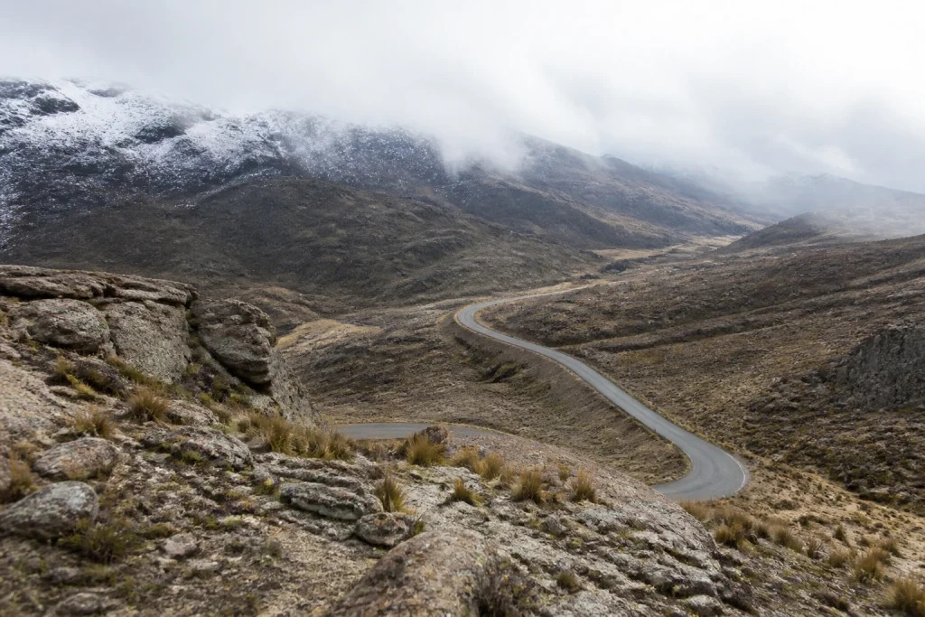
Start with a flexible framework. Weather and road-surface conditions can change quickly on Argentina’s mountain and border roads, so fixed driving assumptions are a poor fit. Check route status before setting out, leave room for a changed plan, and carry and fit snow chains when winter conditions require them.
- Check road status on the travel day instead of building the itinerary around rigid drive times.
- Use a rental car for the greatest flexibility around Quebrada del Condorito’s limited bus connections.
- Treat Talampaya as a self-drive or arranged-transfer stop reached via National Route 76 and connections with National Route 40.
- Plan Quebrada del Condorito as a self-sufficient walking day, with food and drinking water packed in advance.
- Use an authorized trekking guide for activities where the park requires one, including Balcón Sur, traverses, and night visits.
A useful itinerary separates the trip into adaptable blocks rather than forcing a single fast loop. Place the Córdoba park day where the Altas Cumbres route looks workable, then add Talampaya only after arranging the transport that suits your route. This approach protects time for weather holds, closures, and the slower rhythm of remote trailheads.
If the wider journey continues into higher-elevation areas beyond the stops covered here, the separate Altitude in the Andes: A Plain-English Acclimatisation Guide can help you plan that distinct part of the trip without treating Argentina’s varied mountain regions as one uniform destination.
| Adventure component | Useful access anchor | Best planning approach | Key practical point |
|---|---|---|---|
| Quebrada del Condorito National Park | La Pampilla at km 59.5 on Provincial Route 34 | Rental car or carefully timed bus connection | Córdoba’s airport is about 90 km from the park entrance. |
| Talampaya National Park | National Route 76, with connections via National Route 40 | Self-drive or arranged transfer | Use Villa Unión, Patquía, Chilecito/Nonogasta, and Guandacol as routing references. |
| Mountain-road travel | Travel-day route status | Flexible route and backup time | Winter conditions can require snow chains. |
Make Quebrada del Condorito the active Córdoba component
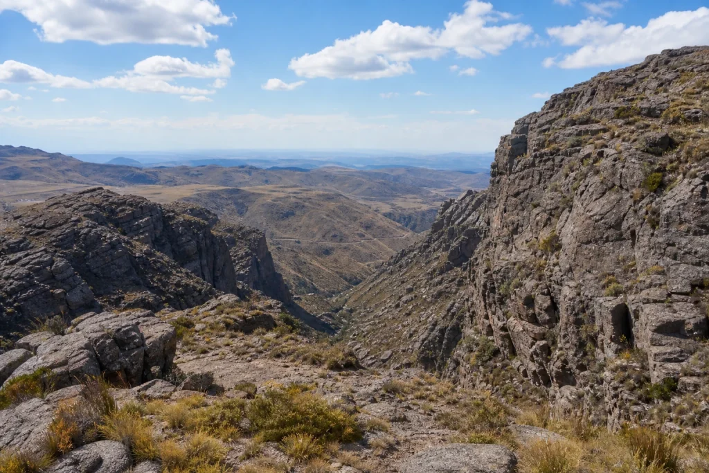
Quebrada del Condorito suits travelers who want a proper walking day rather than a quick roadside stop. Access is via La Pampilla at km 59.5 on Provincial Route 34. Regular buses can stop there, but services are limited, especially compared with the freedom of a rental car. For many itineraries, driving is the more practical way to control arrival, supplies, and the return journey.
Prepare for a self-sufficient trail day
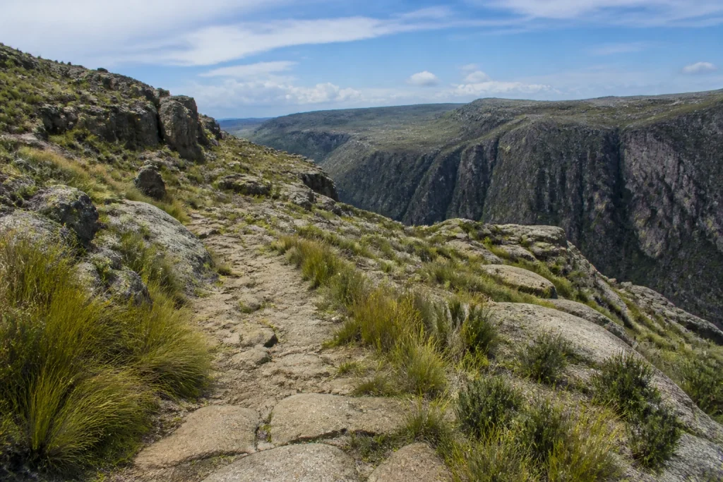
The route to Balcón Norte is an approximately 5 km pedestrian trail from the second parking area. Bring your own food and drinking water: the park reports no food service, overnight lodging, or potable water. The visitor center has toilets and a multipurpose storm-shelter room, but those facilities do not replace a day pack prepared for changing mountain conditions.
This is not a broadly accessible, drive-to-viewpoint outing. Larger buses and trucks over 8 m are not accommodated in park parking areas, and reaching Balcón Norte requires the full pedestrian approach. Travelers with mobility concerns should assess the route carefully before building the park into their itinerary.
Know when a guide is required
Independent visitors can organize ordinary vehicle, walking, and cycling excursions, but the park requires authorized trekking guides for Balcón Sur, traverses, and night visits. The park also recommends guides for a safer and more rewarding experience across these activities. Choose the independent option for a straightforward, well-prepared day, and use an authorized guide when the route or activity calls for that support.
Add Talampaya as a northwestern canyon stop
Talampaya National Park adds a northwestern desert-and-canyon dimension to an Argentina adventure route. The park is accessed from National Route 76, with routing connections via National Route 40. Villa Unión, Patquía, Chilecito/Nonogasta, and Guandacol are useful reference points when shaping the approach and onward journey.
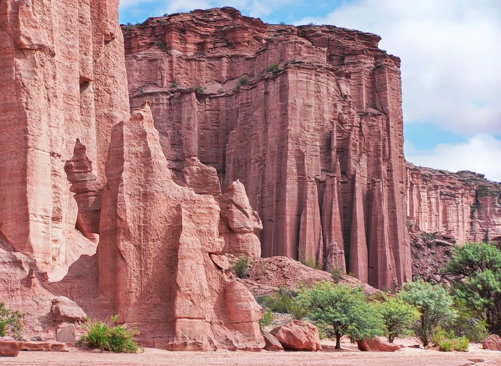
Plan Talampaya as a self-drive or arranged-transfer stop rather than assuming a frequent public-transport connection. That decision affects the whole itinerary: secure the transport plan first, then place lodging and other stops around it. The result is a calmer route with fewer dependencies on scarce connections.
Choose between independent driving and guided support
Driving gives the greatest freedom for remote access points, park approaches, and changing plans. It also places the responsibility for gravel, closures, winter equipment, and mountain-driving decisions squarely with the traveler. Choose this style if you are comfortable checking conditions, adapting the route, and carrying what the day requires.
Guided support is most valuable when park rules require it or when you prefer an experienced lead for more involved routes. At Quebrada del Condorito, use an authorized trekking guide for the activities specified by the park. Confirm the exact meeting point, inclusions, and timing in the booking confirmation so the guide plan fits the rest of the day.
Match the Córdoba park visit to the season
At Quebrada del Condorito, winter runs from April through September and summer from October through March. Each period has its own access concern: ice can close the Altas Cumbres route in winter, while dense summer fog can do the same. Check the live park information shortly before departure rather than relying on a routine daily access schedule.
If arriving by bus, book ahead for January through March, July, and long weekends. Demand can exceed the limited service available at La Pampilla. A car remains the simpler choice for travelers who need flexibility, but it does not remove the need to check road conditions before leaving Córdoba.
Set a flexible budget and reserve the essentials
Do not build this trip around a single published total. Transport, car rental, guides, lodging, and park costs change with the route and travel period. Before booking, check the relevant national park’s current tariff page and online ticket channel, then make the transport decision that matches the access plan.
Prioritize the bookings that protect the route: a vehicle if you need road flexibility, bus seats during peak periods, and an authorized guide when your planned activity requires one. Keep the itinerary light enough that a weather or road adjustment does not undo the whole vacation.
Use current safety and health information
As of August 17, 2026, the U.S. Department of State lists Argentina at Level 1, “Exercise normal precautions,” in its advisory issued July 10, 2026. For this style of trip, the most immediate practical safeguard is road readiness: check the route on the day of travel and carry and fit chains when conditions require them.
The same advisory notes a CDC Level 1 Travelers’ Health Notice for Andes virus, also known as hantavirus, and describes the risk for most travelers as extremely low. Review current health guidance alongside road and weather information as departure approaches, especially when the itinerary includes remote outdoor areas.
Pack for a park day with limited services
For Quebrada del Condorito, pack drinking water, food, weather-suitable layers, and the equipment needed for the walking plan. There is no potable water, food service, or overnight lodging in the park. Keep those essentials with you rather than treating the visitor center as a supply point.
For a winter road itinerary, make snow-chain readiness part of the vehicle plan, not an afterthought. Check that chains fit the vehicle before entering a route where conditions could require them. A well-packed vehicle and a flexible schedule are more useful here than an overstuffed list of fixed stops.
Build an Argentina mountain trip that can adapt
This adventure vacation suits independent travelers who enjoy a road-led plan, a prepared walking day, and the freedom to adjust for conditions. Quebrada del Condorito provides the active Córdoba chapter; Talampaya supplies the northwestern canyon chapter. Keep the route modular, secure the essential transport and guide arrangements, and let current road information make the final call on each mountain day.
Frequently asked questions
Do I need a rental car for Quebrada del Condorito?
A rental car is the most flexible option for Quebrada del Condorito. Regular buses can stop at La Pampilla, but service is limited, while driving gives you more control over supplies and timing.
How do I reach Quebrada del Condorito from Córdoba?
Reach the park via La Pampilla at km 59.5 on Provincial Route 34. Córdoba’s airport is about 90 km from the park entrance, and limited regular bus services can stop at La Pampilla.
Can I visit Quebrada del Condorito without a guide?
Yes, for a standard prepared visit, but some activities require an authorized trekking guide. Balcón Sur, traverses, and night visits fall into that category.
What facilities are available at Quebrada del Condorito?
The park has visitor-center toilets and a multipurpose storm-shelter room, but no food service, overnight lodging, or potable water. Bring food and drinking water for the day.
When is the best season for Quebrada del Condorito?
The right season depends on your tolerance for road conditions. Winter is April through September, when ice can close the Altas Cumbres route; summer is October through March, when dense fog can cause closures.
What should I check before an Argentina mountain driving day?
Check route status on the travel day and be ready to use snow chains if conditions require them. Road and weather conditions can change suddenly on mountain routes.